-
Apks Mods
-
Maps and Navigation
-
Tube Map London Underground
Tube Map London Underground is a Maps and Navigation App for Android developed by Visual IT Limited.
Download the latest version (2.6.0) of the apk here, in Apks Mods released February 27, 2021
Tube Map London Underground Unlocked has been downloaded 1,000,000+ since February 27, 2021. Is Free and the file size is 5.6 MB. Offers in app purchases, users rated it with 4.4/5 stars with over 13054 ratings.
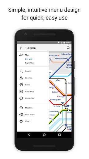
Offline tube map and route planner for the London underground
● NO INTERNET CONNECTION REQUIRED ●
● Latest official TFL (Transport For London) tube map.
● Instant routing while offline
● Simple, fast and easy to use.
● Designed for the first time visitor and experienced commuter.
● Unique "Minute Map" feature provides a view of travel times from any location on the map.
● Planned route animates on the tube map.
●.Switch to online street map (when an internet connection is available).
● Services can be turned on or off, routing around problems.
● Works in both landscape and portrait modes.
● Easily locates your nearest London transport stop.
● Places of interest, parks etc are built in to the application.
● Offline routing with clear map and text views
● GPS locating
● Station exit information
● Live service status and departure board information
● OVERVIEW ● The London Tube Map application is a superb route planner for the London Underground (Tube)system with many unique features. The inbuilt map provides the official TFL map of the city underground services with the ability to switch to an online street map view when an internet connection is available. This way the user can view the online map feature when above ground and the transport map and route planning is still fully functional underground or anywhere there is no internet connection. This provides the best of both worlds, the transport map and route planning anytime, anywhere and online street maps and search when a connection is available.
● ROUTING ● Does not require an internet connection and will always be available to display a clear and detailed view of the city transport system, plus list and animate the optimum route for your journey. Provides the fastest route calculations of any mobile routing application (virtually instantaneous) using actual published journey times with the ability to select the quickest route or the route with the least changes.
Comprehensive details of your planned route are provided, including changes, directions of travel, number of stops, predicted journey times, etc. Uniquely this application gives you “direction”, “towards” and “service frequency” information (not available on any other offline journey planner) for example “Take the Northern line (Southbound) towards Stockwell for 10 mins (6 stops). Service runs every 7 minutes” which is essential when finding the correct platform and connection. Also given are alternatives for each leg of the journey.
● NO INTERNET CONNECTION REQUIRED ● The tube map and routing do not require an internet connection and therefore you will not be charged data connection fees. This also means the application runs perfectly underground, on an aeroplane, etc. For international visitors to a city who have data roaming turned off this is an ideal solution.
● LIVE INFO ● When an internet connection is available, optional "Live Information" on the current state of the transport services and real time station departure boards can be viewed allowing you to plan your journeys in advance and avoid any potential delays. Unique to this application is the ability to turn off services that are out of action and automatically calculate an alternative route.
● MINUTE MAP ● This unique feature provides a view of travel times from any location on the map. This is helpful for getting a sense of scale and connectivity of the transport system and can provide some interesting results.
More Maps and Navigation Application
★★POWERFUL★★
★★EASY TO USE★★
★★MOST ACCURATE★★
GPS Speedometer
"The single best app for finding your way in the city"
The New York Times
Earn more by executing orders of different taxi companies in one application.
The simple and beautiful way to get around. 200+ cities across the globe.
Car GPS with driving directions, live traffic, speed radar & Offline USA map
Real-Time Transit: bus times, train times, subway maps, live directions & alerts
Avenza Maps is a powerful offline map viewer with a connected in-app Map Store
GPS for marine, hiking, off road, trail navigation. FREE offline maps and charts
Ride via taxi affordably, quickly and safely
Off-road GPS navigator with offline maps support, compass and track recording.
Navmii - crowd-powered GPS navigation with offline maps, traffic (Navfree)
Find Driving Directions using GPS, Maps, Voice Navigation & Directions App
Detailed Information:
Maps and Navigation Android Application
| Updated |
Size |
Installs |
| February 27, 2021 |
5.6 MB |
1,000,000+ |
| Version |
Rating |
Ads |
| 4.0 and up |
Everyone |
Contains ads |
| Price |
In-App Purchase |
| Free |
Yes |
| Version Release |
Changes |
| 2.6.0 |
Map update |